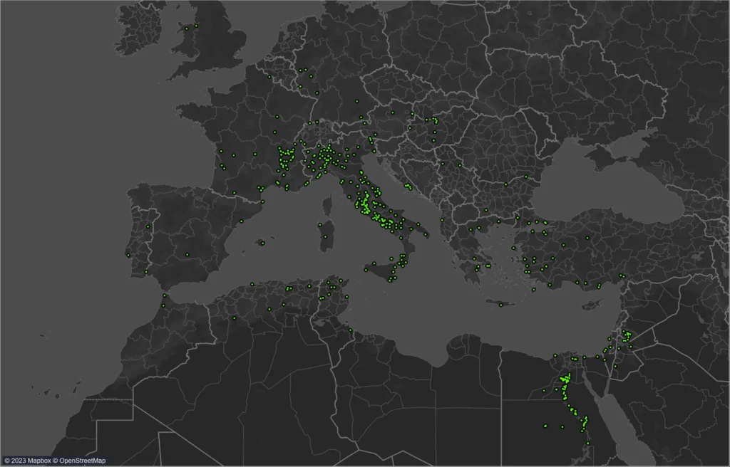
In 2019 Kieran Baker and Marco Dosi were awarded a Small Grant for Research Students by the Faculty of Arts and Humanities, King’s College London, to perform statistical tests (e.g. algorithmic processing, logistic regression analysis) on the consular dataset, which culminated in the development of a geospatial model that is able to predict the expected dissemination times of consular announcements
The model is nearing completion and will be accompanied by the imminent release of an interactive map for exploring its capabilities.
The essence of this model lies in its application of the Cox Proportional Hazards model—a statistical method conventionally used in medical research for survival analysis. This approach is adept at handling time-to-event data, particularly useful in contexts where the exact timing of an event is uncertain within a given timeframe. The team has adeptly adapted this model to address the unique challenges of spatio-temporal data inherent in historical research, creating three distinct models that cater to different scales of geographic specificity. From the precise location of a consul’s announcement to broader regional and macro-regional contexts, these models are designed to provide reliable estimates of dissemination times, accommodating the varying levels of data availability encountered in historical datasets.
A significant innovation of this approach is its proficiency in dealing with censored data, a common obstacle in historical research. The models classify consular data into three categories based on the completeness of information and stages of information dissemination, enabling a nuanced analysis of the dissemination process across different scenarios. By incorporating variables such as the year of the event, starting location, and estimated travel times—sourced from the ORBIS travel model—the model adjusts survival curves to offer a detailed perspective on the dynamics of information flow.
The KCL Dissemination Algorithm and Geospatial Model represent a quantum leap in the study of ancient information dissemination, providing a sophisticated tool that bridges historical inquiry with statistical and geospatial analysis. This ground-breaking work not only forecasts dissemination times with unprecedented accuracy but also enriches our understanding of the movement, geography and bureaucratic mechanisms of ancient societies.
Beyond its historical applications, the model’s methodology offers profound implications for contemporary research, particularly in fields grappling with incomplete or censored data and the critical role of spatial dynamics. This pioneering study showcases the potential of integrating advanced statistical models with geospatial data, setting a new benchmark for historical and geographical research and opening new avenues for interdisciplinary exploration.

